Gibraltar - GI - GIB - Europe
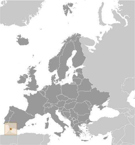
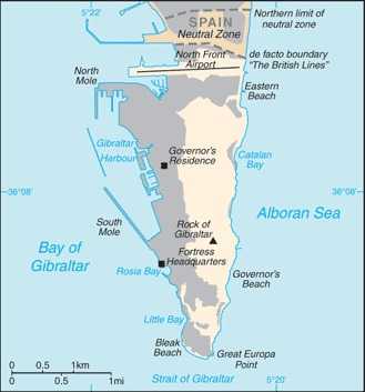
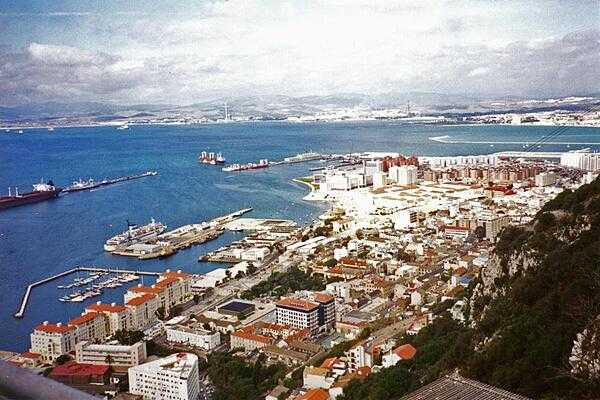
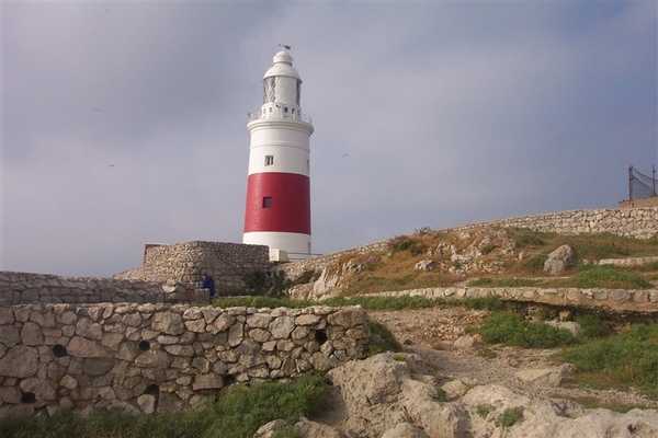
Gibraltar Images
Gibraltar Factbook Data
Dependency status
Diplomatic representation from the US
Age structure
15-64 years: 62.5% (male 9,383/female 9,179)
65 years and over: 17.5% (2024 est.) (male 2,491/female 2,690)
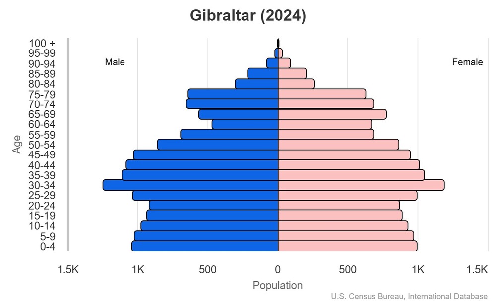
For additional information, please see the entry for Population pyramid on the Definitions and Notes page.
Geographic coordinates
Sex ratio
0-14 years: 1.05 male(s)/female
15-64 years: 1.02 male(s)/female
65 years and over: 0.93 male(s)/female
total population: 1.01 male(s)/female (2024 est.)
Natural hazards
Area - comparative
Background
Spain reluctantly ceded the strategically important Gibraltar to Great Britain in the 1713 Treaty of Utrecht, and the British garrison at Gibraltar was formally declared a colony in 1830. In a referendum held in 1967, Gibraltarians voted overwhelmingly to remain a British dependency. After the UK granted Gibraltar autonomy in 1969, Spain closed the border and severed all communication links. Between 1997 and 2002, the UK and Spain held a series of talks on establishing temporary joint sovereignty over Gibraltar. In response to these talks, the Gibraltar Government called a referendum in 2002 in which the majority of citizens voted overwhelmingly against sharing sovereignty with Spain. Since 2004, Spain, the UK, and Gibraltar have held tripartite talks to resolve problems that affect the local population, and work continues on cooperation agreements in areas such as taxation and financial services, communications and maritime security, legal and customs services, environmental protection, and education and visa services. A new noncolonial constitution came into force in 2007, and the European Court of First Instance recognized Gibraltar's right to regulate its own tax regime in 2008. The UK retains responsibility for defense, foreign relations, internal security, and financial stability.
Spain and the UK continue to spar over the territory. In 2009, for example, a dispute over Gibraltar's claim to territorial waters extending out three miles gave rise to periodic non-violent maritime confrontations between Spanish and UK naval patrols. Spain renewed its demands for an eventual return of Gibraltar to Spanish control after the UK’s 2016 vote to leave the EU, but London has dismissed any connection between the vote and its sovereignty over Gibraltar.
Environmental issues
Exports - commodities
note: top five export commodities based on value in dollars
Exports - partners
note: top five export partners based on percentage share of exports
Agricultural products
Capital
geographic coordinates: 36 08 N, 5 21 W
time difference: UTC+1 (6 hours ahead of Washington, DC, during Standard Time)
daylight saving time: +1hr, begins last Sunday in March; ends last Sunday in October
etymology: from the Spanish derivation of the Arabic jabal tariq, which means "Mountain of Tariq" and refers to the Berber chief who captured the peninsula in A.D. 711
Imports - commodities
note: top five import commodities based on value in dollars
Climate
Coastline
Constitution
amendment process: proposed by Parliament and requires prior consent of the British monarch (through the Secretary of State); passage requires at least three-fourths majority vote in Parliament followed by simple majority vote in a referendum; note – only sections 1 through 15 in Chapter 1 (Protection of Fundamental Rights and Freedoms) can be amended by Parliament
Exchange rates
Exchange rates:
0.782 (2024 est.)
0.805 (2023 est.)
0.811 (2022 est.)
0.727 (2021 est.)
0.78 (2020 est.)
Executive branch
head of government: Chief Minister Fabian PICARDO (since 9 December 2011)
cabinet: Council of Ministers appointed from among the 17 elected members of Parliament by the governor, in consultation with the chief minister
election/appointment process: the monarchy is hereditary; governor appointed by the monarch; following legislative elections, the governor usually appoints the leader of the majority party or majority coalition as chief minister
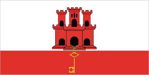
Flag
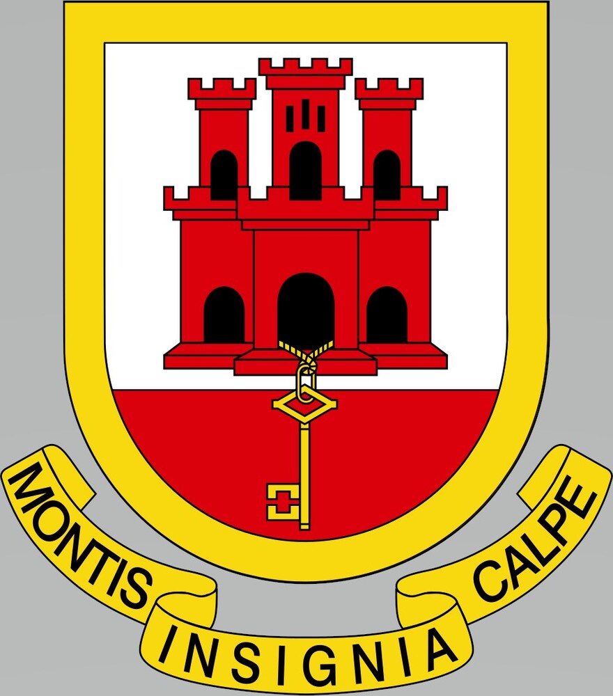
meaning: the castle symbolizes Gibraltar as a fortress, and the key represents Gibraltar's strategic importance -- the key to the Mediterranean
history: the design comes from Gibraltar's coat of arms, which King Ferdinand and Queen Isabella of Spain granted on 10 July 1502
Independence
Industries
Judicial branch
judge selection and term of office: Court of Appeal and Supreme Court judges appointed by the governor upon the advice of the Judicial Service Commission, a 7-member body of judges and appointees of the governor; tenure of the Court of Appeal president based on terms of appointment; Supreme Court chief justice and judges normally appointed until retirement at age 67, but tenure can be extended 3 years
subordinate courts: Court of First Instance; Magistrates' Court; specialized tribunals for issues relating to social security, taxes, and employment
note: appeals beyond the Court of Appeal are heard by the Judicial Committee of the Privy Council (in London)
Land boundaries
border countries (1): Spain 1.2 km
Land use
forest: 0% (2022 est.)
other: 100% (2022 est.)
Legal system
Legislative branch
legislative structure: unicameral
number of seats: 18 (17 directly elected, 1 appointed)
electoral system: plurality/majority
scope of elections: full renewal
term in office: 4 years
most recent election date: 10/12/2023
parties elected and seats per party: GSLP-Liberal Alliance (9) (GSLP 7, LPG 2); GSD (8)
percentage of women in chamber: 38.5%
expected date of next election: October 2027
Maritime claims
International organization participation
National holiday
note: day of the national referendum to decide whether to remain with the UK or join Spain
Nationality
adjective: Gibraltar
Natural resources
Geography - note
Economic overview
Political parties
Gibraltar Social Democrats or GSD
Gibraltar Socialist Labor Party or GSLP
GSLP-Liberal Alliance
Together Gibraltar or TG
Suffrage
Terrain
Government type
Military - note
Country name
conventional short form: Gibraltar
etymology: from the Spanish derivation of the Arabic jabal tariq, which means "Mountain of Tariq" and refers to the Berber chief who captured the peninsula in A.D. 711
Location
Map references
Irrigated land
Diplomatic representation in the US
Internet users
Internet country code
GDP (official exchange rate)
Urbanization
rate of urbanization: 0.45% annual rate of change (2015-20 est.)
Broadcast media
National anthem(s)
lyrics/music: Peter EMBERLEY
history: adopted 1994; serves as a local anthem
_____
title: "God Save the King"
lyrics/music: unknown
history: official anthem, as an overseas UK territory
Major urban areas - population
National symbol(s)
Civil aircraft registration country code prefix
Ethnic groups
note: data represent population by nationality
Religions
Languages
Imports - partners
note: top five import partners based on percentage share of imports
Elevation
lowest point: Mediterranean Sea 0 m
Dependency ratios
youth dependency ratio: 32 (2024 est.)
elderly dependency ratio: 27.9 (2024 est.)
potential support ratio: 3.6 (2024 est.)
Drinking water source
urban: 100% of population (2022 est.)
total: 100% of population (2022 est.)
unimproved:
urban: 0% of population (2022 est.)
total: 0% of population (2022 est.)
Sanitation facility access
urban: 100% of population (2022 est.)
total: 100% of population (2022 est.)
unimproved:
urban: 0% of population (2022 est.)
total: 0% of population (2022 est.)
Electricity access
Waste and recycling
Electricity generation sources
Natural gas
imports: 77.196 million cubic meters (2023 est.)
Petroleum
Ports
large: 0
medium: 1
small: 0
very small: 0
ports with oil terminals: 1
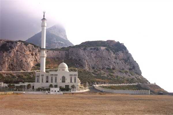
key ports: Europa Point
National color(s)
National coat of arms
Population
male: 14,919
female: 14,764
Carbon dioxide emissions
from petroleum and other liquids: 15.458 million metric tonnes of CO2 (2023 est.)
from consumed natural gas: 150,000 metric tonnes of CO2 (2023 est.)
Area
land: 6.5 sq km
water: 0 sq km
Airports
Telephones - mobile cellular
subscriptions per 100 inhabitants: 112 (2022 est.)
Broadband - fixed subscriptions
subscriptions per 100 inhabitants: 61 (2022 est.)
Electricity
consumption: 213.744 million kWh (2023 est.)
transmission/distribution losses: 6.256 million kWh (2023 est.)
Merchant marine
by type: bulk carrier 8, container ship 5, general cargo 31, oil tanker 16, other 69
Telephones - fixed lines
subscriptions per 100 inhabitants: 46 (2022 est.)
Life expectancy at birth
male: 78.1 years
female: 83.8 years
Education expenditure
Military and security forces
Gross reproduction rate
Net migration rate
Median age
male: 36.2 years
female: 37.5 years
Total fertility rate
Infant mortality rate
male: 6.8 deaths/1,000 live births
female: 5.2 deaths/1,000 live births
